On 2 May, CNBC, citing officials with knowledge of U.S. intelligence, reported that China has deployed the type of medium-range missile systems to the Spratly Islands that would enable Beijing to deny safe operation to other nations in the South China Sea.
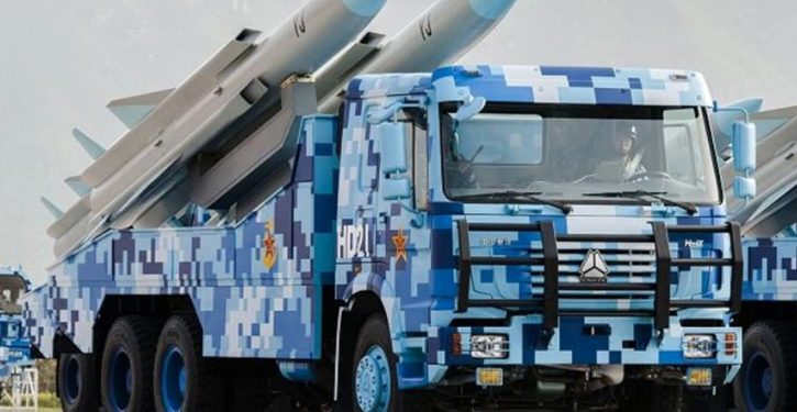
According to CNBC, China has put anti-ship cruise missiles (ASCMs), and surface-to-air missiles (SAMs) similar to the Russian S-300 system, on Fiery Cross Reef, Mischief Reef, and Subi Reef in the Spratly Islands.


I first previewed this move back in 2011, when China was preparing to move an oil drilling platform into the exclusive economic zone (EEZ) of the Philippines based on China’s excessive (unrecognized) island claims in the South China Sea. (Map at the end, below.)
At the time, although China had yet to develop the reefs she had staked out positions on in the Spratly archipelago, I presented this map showing what the Chinese military could achieve by placing the YJ-62 (“C602”) anti-ship cruise missile on the Chinese-occupied islands and reefs.

I stress that none of this threat coverage existed in 2011. The above map was my presentation of a worst-case scenario if China’s potential activities could be undertaken unabated. The actual threat-missile picture looked more like this, as 2011 transitioned into early 2016.

Since 2011, China has had the latitude to undertake – and expand – the necessary infrastructure-building activities. The Chinese were occupying islands and reefs to which the international community did not recognize their claims. But no one was doing anything about it.
Beijing has had an extensive “reclamation” effort underway in the Spratlys since early 2014, using massive dredging operations to create artificial “islands” from the existing reefs, so that military infrastructure including runways, radars, barracks, and missile sites can be supported.
The sites cited by CNBC – Fiery Cross Reef, Mischief Reef, and Subi Reef – were among those being developed.

China has also been putting military infrastructure on Woody Island in the Paracels (which Beijing disputes with Vietnam and Taiwan). In early 2016, China was detected conducting an exercise ASCM launch from Woody Island, and ASCM launchers and other equipment were observed there. Near the same time, the HQ-9 SAM was observed on Woody Island.
So by mid-2016, the threat picture for ships and aircraft in the South China Sea had come to look more like this.


One other development was transforming the environment during this period. China operationalized the YJ-12 ASCM in her inventory. The YJ-12 is a supersonic cruise missile with a range of about 250 (statute) miles (400 km), making it significantly more lethal and harder to defend against than the YJ-62. The YJ-62 in the Chinese fleet variant has a similar range, but is a subsonic missile. Bringing the YJ-12 into China’s maritime bag of tricks creates a much greater threat even for modern navies – let alone for defenseless merchant ships.
Observers continued to update the progress of the Chinese “reclamation” projects in the Spratlys. This depiction by the Asia Maritime Transparency Initiative at the Center for Strategic and International Studies was from mid-2015, showing that the reclamation at Fiery Cross Reef was completed, while the ones at Mischief and Subi Reefs were still ongoing.

All three reclamations were completed, however, in the period since that report. And now, in addition to the HQ-9 and ASCM deployments at Woody Island, the Chinese reportedly have the HQ-9 and YJ-12 – the newer, supersonic ASCM – deployed to the Spratly Island reefs.
It isn’t clear whether the systems are all deployed to all three “reclaimed” reefs, now functioning as artificial islands. The maps below, showing the situation in 2018, present the worst case; i.e., that launchers for both systems, SAMs and ASCMs, are deployed to all three reefs.

As the map shows, it is now impossible for ships to transit to the Strait of Malacca through the South China Sea without running a gauntlet of supersonic anti-ship missiles. This is exactly the situation I previewed in 2011 (although in 2011 I assumed the older, subsonic YJ-62 as the threat).
On the HQ-9 maps, the highest-traffic commercial air corridors are depicted in the light magenta.

The HQ-9, which would be extremely effective against commercial aircraft (and meaningfully complicate operations for military aircraft), has a limited range relative to the geography of the South China Sea. However, Russia began delivering the S-400 SAM system to China earlier this year. If China were to put the S-400 in the Spratly Islands, its greater range would quickly put all air traffic in the southern South China Sea at risk.

The hard part for that scenario is completed. The artificial islands are developed, and ready for whatever missile systems China wants to put on them. As soon as China is operating the S-400 routinely – which will be quickly, since it’s basically an upgrade to the HQ-9 the Chinese have been operating for years – the potential of the S-400 threat from the Spratlys will be immediate.
It probably won’t be long, moreover, before China has an anti-air missile threat like the Russian S-500 to deploy. The S-500’s intercept range (up to 380 miles, depending on target geometry) is considerably greater even than the S-400’s. With only three deployment positions, China could put the airspace of almost the entire South China Sea under threat.

Virtual territory
Note that this is not an unlikely scenario. It’s not the 1980s anymore, and long-range anti-air intercept need no longer be dedicated to the layered defense of very high-value targets like a capital city. The HQ-9, S-400, and S-500 are all mobile systems, meant to be moved for optimization as conditions shift.
Moreover – and this is exceptionally important to keep in mind – China’s purpose in developing the archipelagic reefs of the South China Sea is to turn the sea into virtual land. Instead of the sea being subject to the international conventions of maritime movement, China can make it subject to Chinese-imposed regulation.
Hong Kong, for example, would then have the advantages of being both accessible by sea, but as protected and non-exposed as if it were a city surrounded by land. The whole South China Sea would become a great Chinese peninsula. China would dictate the conditions of movement through it, as if it were the territory of China.
When you see the famous “9-dash-line” map of China’s excessive maritime claims, that’s what you need to understand. The 9-dash-line is only partly about claiming the right to natural resources. It is about that; but it’s about more.

And the “more” transforms the entire region, if China can bring this off. Draw the geography in your head. If there were a land mass extending to the 9-dash-line, instead of sea, how would that change the behavior and calculations of all the other nations in the Far East – and all nations that make use today of the maritime tradeways?
If China can exercise a veto over maritime and air movement in the South China Sea, and extort other nations politically as a condition of safe passage there, then the South China Sea might as well be land.
That would give China not just a nice basin full of mine-able goodies, but an extended springboard for power projection.
This situation too, like the Middle East’s looming inflection point, is coming to a head. It’s a Chinese vision of longstanding, one Beijing was able to exploit the quiescence of the Obama administration to accelerate. It’s much bigger and more geopolitically systemic than anything that could be addressed by simplistic things like rolling over on tariff policies. That’s not what this is even about.
China’s move isn’t about retaliation for anything Trump has done. It’s the culmination of a plan the Chinese have been working on for a long time. When I have spoken before of China, under Xi Jinping, moving toward a “war footing,” it’s because Xi is clearly cracking down internally in order to have the unified command environment to do things like this. It’s 2018, and interesting times follow us wherever we go.